Technical sheet
Read moreRead less- Location
- Diest (centre, Kaggevinne, Schaffen, Deurne, Molenstede, Webbekom)
- Date
- 2022-...
- Partner
- Archivolt
- Client
- Government
- Study partners
- -
- Status
- Studie ongoing, participation phase
Kerken met toekomst Diest
Feasibility study for the secondary use or repurposing of six churches in Diest, including an extensive analysis phase, historical research, participatory process and design investigation
In 2018, the Church Policy Plan for the parishes within the city of Diest was published. It outlined future uses and functions for each of the city’s church buildings. That future was categorised into four possible directions: valorisation, shared use, secondary use (nevenbestemming), and full repurposing. The policy plan established a framework to guide this search for new roles for church buildings; one that explicitly calls for public input and participation from the wider local community. Any proposed shift in function should go beyond the church itself and consider the broader spatial and societal context: missing functions in the area, mobility issues, and synergies with existing local infrastructure.
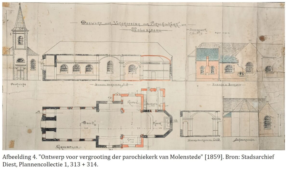
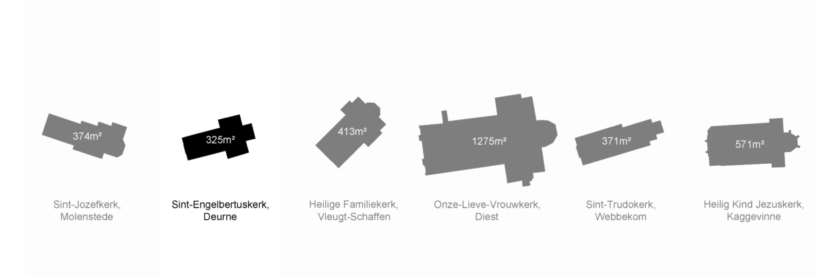
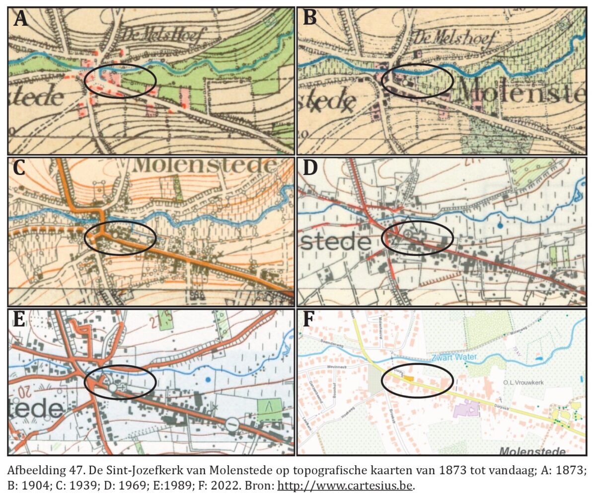
In 2021, the City of Diest commissioned a feasibility study for six specific churches, building upon the foundations laid by the 2018 plan. These churches were: Sint-Engelbertuskerk (Deurne), O.-L.-Vrouwkerk (Diest), Sint-Trudokerk (Webbekom), H. Familiekerk (Vleugt), Heilig Kind Jezuskerk (Kaggevinne) and Sint-Jozefkerk (Molenstede). The assignment consisted of two parts: first, an analysis of each building’s strengths and weaknesses; then, for three selected churches, a follow-up design study exploring possibilities for secondary or new uses.
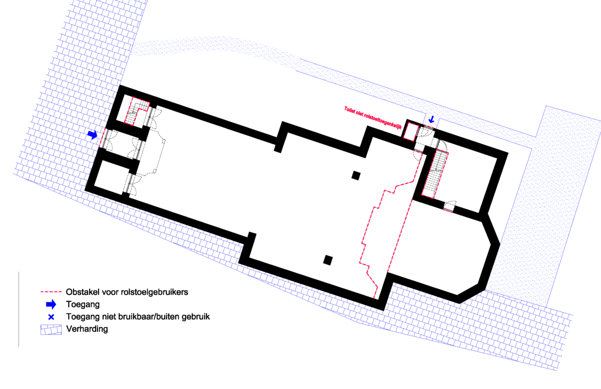
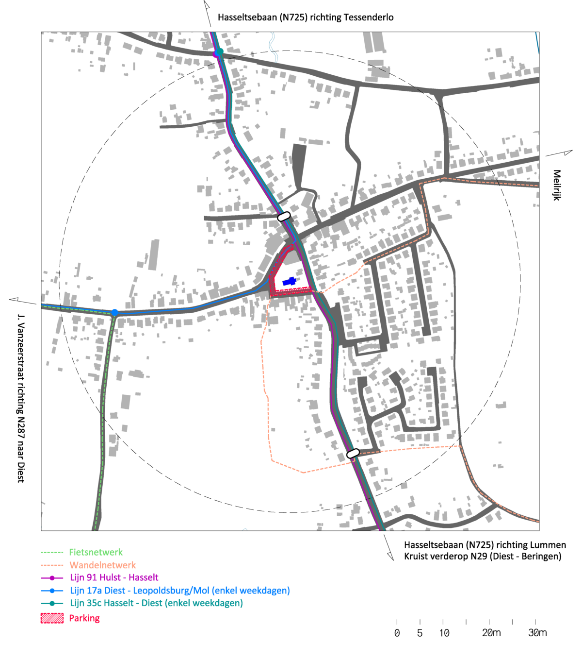
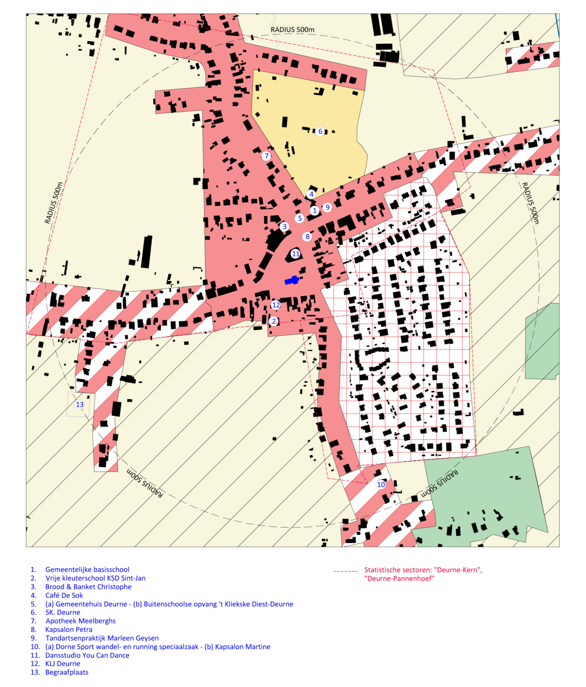
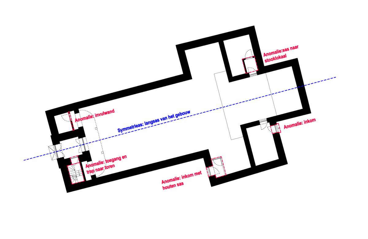
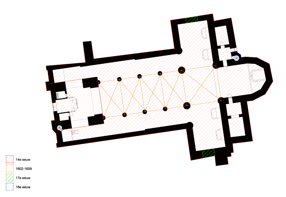
Archivolt and Marge intentionally devoted significant attention to this initial analysis phase. In repurposing studies, it is especially important that proposed uses are deeply embedded in both the spatial and social fabric surrounding the church. That begins with a thorough understanding of the existing context. Phase 1 included: extensive site visits and measurements for all six churches, archival research, a historical report with landscape and architectural evolution maps, inventories of current use, spatial analyses (e.g. daylight access, accessibility, fire safety compliance), assessments of building condition, and evaluations of connectivity at both the micro (paths, entrances) and macro level (road access, tourist routes, public transport). A contextual function map was also created to identify key local amenities and services.
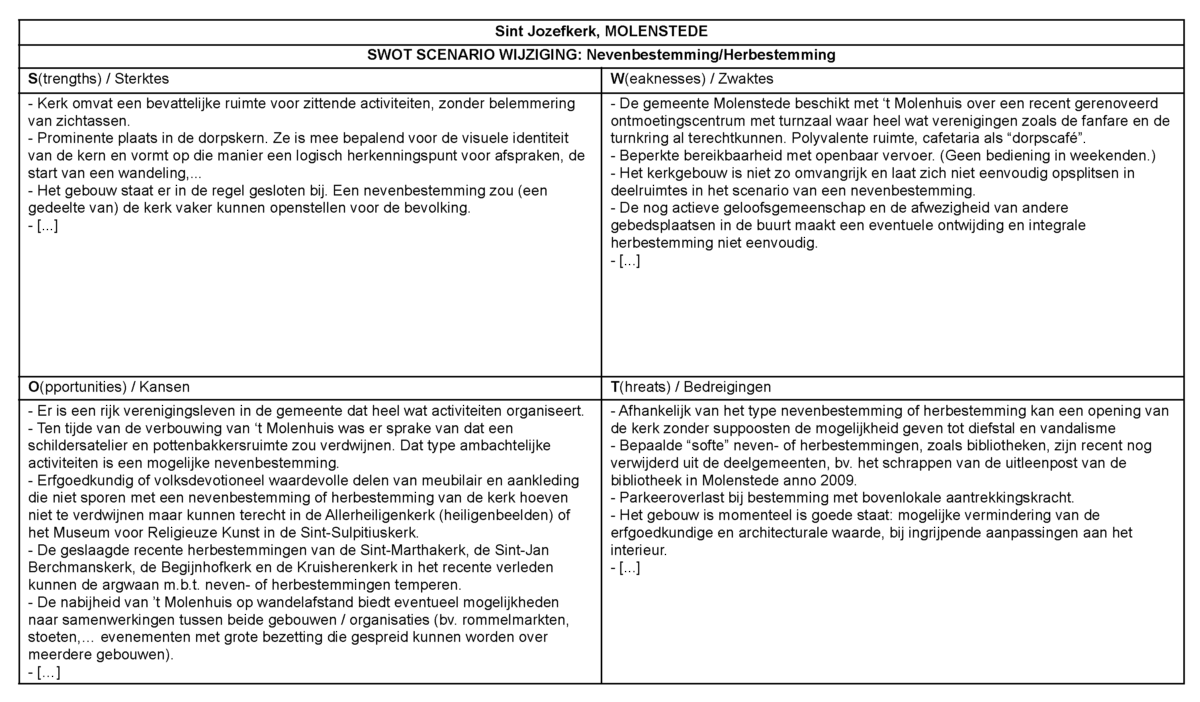
The results of this research, in close consultation with and with input from the respective church boards, were summarised in six SWOT tables. These helped the city and the boards select the three churches to move forward with. Phase 1 is now complete. Phase 2 is underway, beginning with a participatory process: the formation of local working groups for each selected church, composed of residents, associations, and volunteers, who will jointly explore future uses.
The reports from Phase 1 are publicly available at: https://diest.be/kerkenmettoek...
In a second phase, the research becomes concrete. The churches are no longer merely read, but reimagined.
Where the first phase provided insight into history, use and local support, the focus now shifts toward possible futures. For each site, a broad spectrum of scenarios is assembled. This longlist brings together a wide range of trajectories: from preservation to transformation, from public functions to more private forms of use. Each scenario is weighed against a set of spatial, social and economic criteria.
From this multitude, one direction is selected for each church. Not an obvious choice, but a position that emerges through dialogue, nuance and careful consideration. What remains is a scenario robust enough to investigate further, without reducing the complexity of the site.
This scenario then becomes the starting point for design research. In this phase, the programme is not merely described, but spatially tested. How does a new function relate to the scale of the nave, the rhythm of the bays, the presence of choir or tower? Where can the existing structure be reused, and where does it call for intervention?
The proposals seek a balance between preservation and transformation. They depart from what is already there, yet do not hesitate to introduce precise interventions where necessary. New additions, cut-outs or compartmentalisations are deployed as tools to enable new forms of use, without erasing the legibility of the building.
At the same time, the designs also reveal the practical consequences of these choices. Surfaces are defined, circulations developed, and necessary technical interventions mapped out. Each proposal is supplemented with an indicative cost estimate, clarifying the scale of investment and exposing the relationship between different components.
In this way, the design research acts as an intermediate layer between analysis and realisation. Not a final image, but a clarification. A way of translating abstract decisions into spatial possibilities, and of making the impact of those decisions tangible.
The result is not a fixed answer, but a substantiated position from which further decisions can emerge.